GEOPHYSICAL CHARACTERIZATION OF RENEWABLE RESERVOIR AND ENERGY
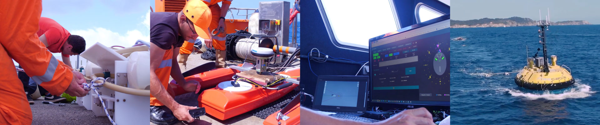
As the world is slowly transitioning to marine renewable energy (MRE), there are a number of energy-related projects that still require high level 3D/4D seismic applications. Kietta revisited the FreeCable concept to adapt it to CO2 geological storage and underground hydrogen storage (or other fluids), wind farm energy, enhanced geothermal systems, deep sea mining, characterization of the water column.
G E O P H Y S I C A L C H A R A C T E R I Z A T I O N
FLUID UNDERGROUND
STORAGE AND MONITORING
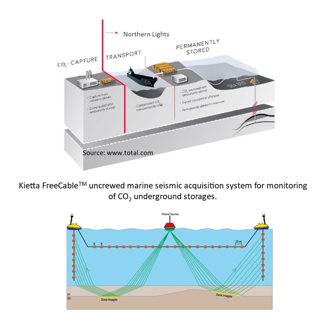
Monitoring offshore CO2 storages is crucial for predicting the risk of CO2 leakage, increasing efficiency, reducing the cost and the risk of induced seismicity. Most monitoring surveys are acquired by towed streamer 3D seismic but are challenging in image quality, frequency of the repeated surveys and survey size of the geophysical targets.
Monitoring of CO2 Underground Storages
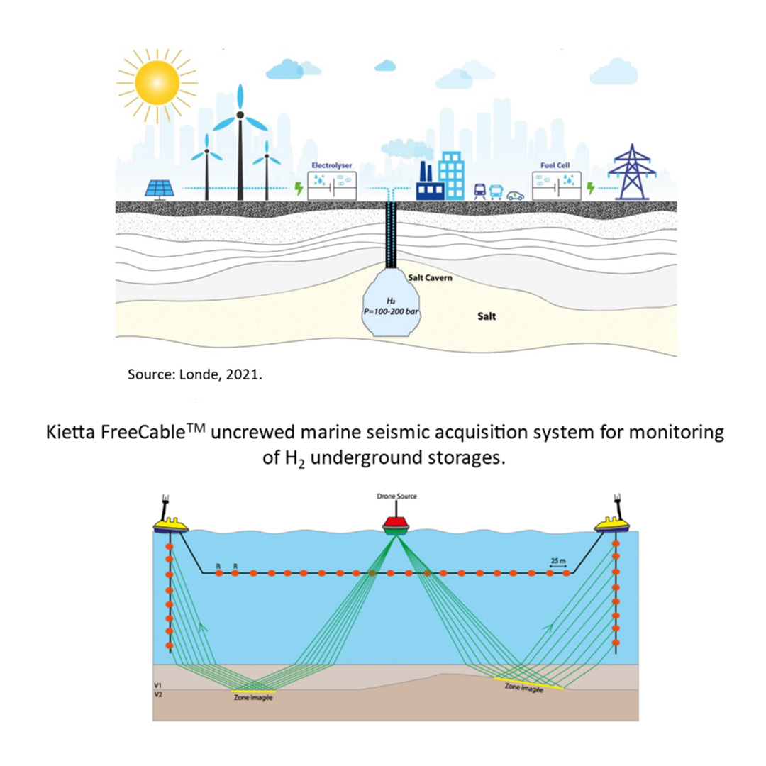
Monitoring of Hydrogen Underground Storages
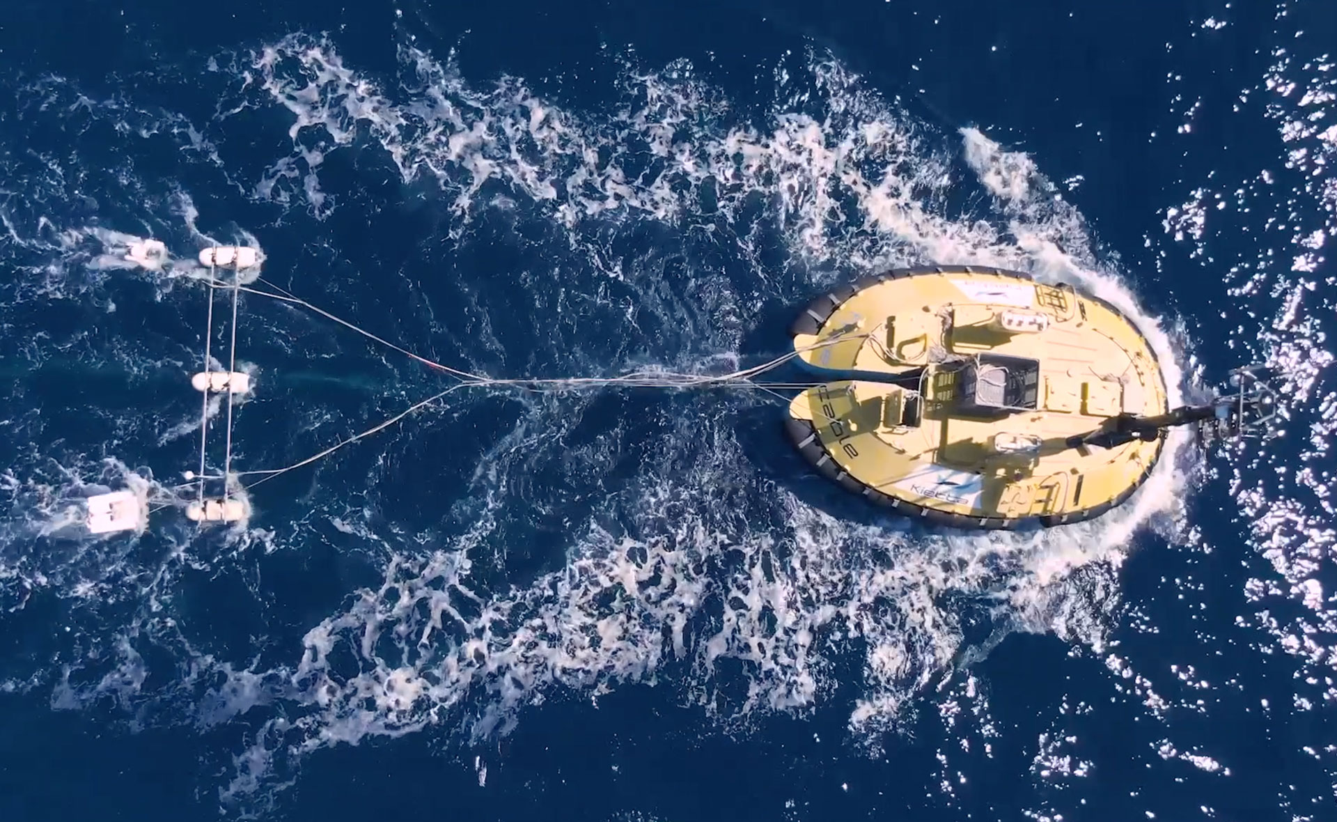
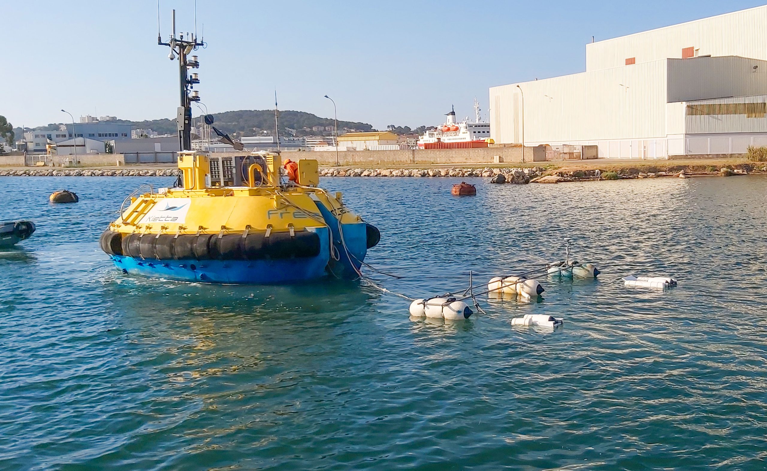
FreeCableTM is an alternative approach to conventional 4D seismic because it enables to deliver a custom-fit and on-demand subsurface image and characterization thanks to the system flexibility e.g. use few short midwater stationary cables to monitor CO2 plume or potential leakage zones.
FreeCableTM flexibility allows to accommodate for future obstructions like windfarms, platforms, or pipelines, ensuring operability for decades of monitoring. FreeCableTM would have positive impact on the commercial viability and environment of CCUS (carbon capture, utilization and storage) projects.
G E O P H Y S I C A L C H A R A C T E R I Z A T I O N
OFFSHORE WIND FARM
Windfarm developers are required to submit a succession of plans for approval before installation of any facility, structure or cable. The ultimate deliverable is a comprehensive site characterization that results from the integration of geophysical & geotechnical data. This approach involves the development of a 3D geological model.
Subsea Siting of Floating Windfarms
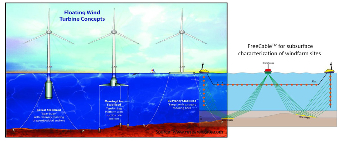
Kietta proposes to replace the usual 2 x 2D surveys (one for foundation micro-siting and one for subsea cable route) by 1 x ultra high-resolution 3D using a swarm of USVs (unmanned surface vehicle) to deliver full results in one pass.
The UHR3D survey will decrease uncertainty of the 3D geological model and will enable a targeted approach for the following geotechnical investigations. Operated with USVs, this will increase productivity and decrease HSE risk, which lead to additional cost savings and reduced delays during the project.
WATER COLUMN AND SUB BOTTOM
G E O P H Y S I C A L C H A R A C T E R I Z A T I O N
GEOTHERMAL
Offshore volcano-hosted high-temperature geothermal reservoirs are powerful resources for green electricity generation. Sustainable geothermal energy utilization depends on the successful siting of geothermal wells, which in turn depends on prior geophysical subsurface imaging and reservoir characterization.
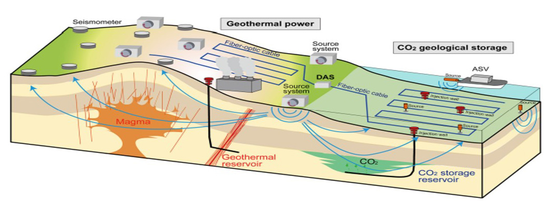
Seismic imaging methods have proven to be a key tool for characterizing magma-driven geothermal systems because velocity is sensitive to the presence of melt and clays that form through hydrothermal alteration. This is one of the reasons why FreeCable marine seismic acquisition system has been developed. The cables being immersed deep in seawater ca. 100-200m and the four-component receiver array being extremely sensitive (hydrophone + triaxial geophone), small energy sources can be operated reducing the CO2 emission and impact on marine life. Because the FreeCable system enables to acquire monitoring (4D) signals in a fit-for-purpose way, the application will deliver high-resolution and low-cost monitoring of geothermal reservoirs.
Kietta has also developing an autonomous vibratory source which enables for the use of advanced seismic surveying techniques. It was numerically demonstrated that using these techniques can reduce acquisition time by one-third compared with conventional air gun acquisition without compromising the quality of the seismic images.
G E O P H Y S I C A L C H A R A C T E R I Z A T I O N
DEEP SEA MINING
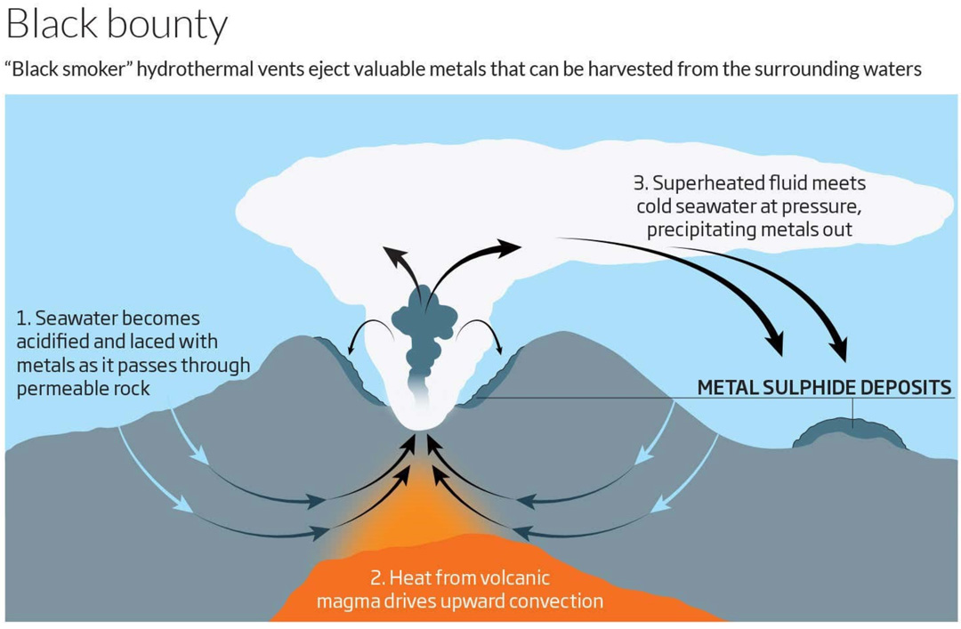
Offshore mineral exploration is at the point of becoming a commercial activity. To characterize these mineral reservoirs or deposits, the seismic data needs to resolve the very near surface (first few decameters) at a very high resolution imaging that enables the location of geological targets with an area extension of 100 to 300m. As demonstrated for offshore wind farm (see above), FreeCable technology delivers high-resolution seismic data. Deepwater being in the system DNA, it will be well suited to image deposits rich in precious metals as well as rare earth minerals in the deep ocean.
G E O P H Y S I C A L C H A R A C T E R I Z A T I O N
CHARACTERIZATION OF THE WATER COLUMN
Active acoustic waves are used in the ocean to detect and locate obstacles and targets (sonar applied to the detection of mines, schools of fish, etc.), to characterize the ambient environment (seabottom topography , currents, living organisms, etc.) and communicate signals (data recorded by sensors, transmission of messages between submarines and surface ships or remotely controlled systems, etc.). There are also passive systems, which exploit the waves emitted by the target itself. All these applications are confronted with the particularities of the ocean, a complex and changing propagation environment, which constitutes a permanent challenge.
Characterization of the Seawater Column with FreeCable
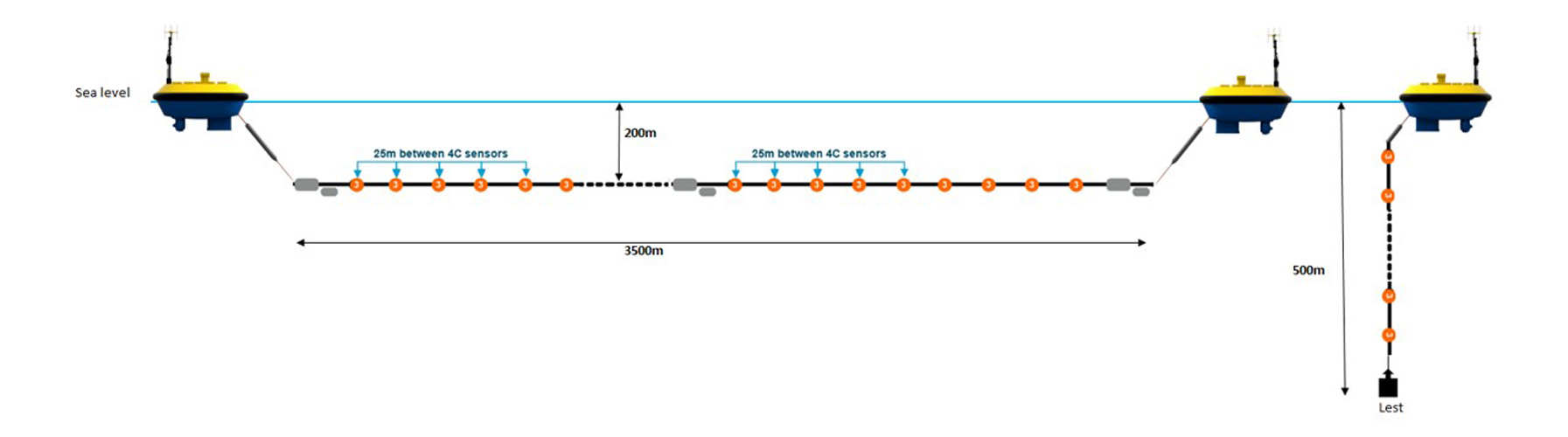
FreeCable long receiver arrays can be deployed horizontally and vertically from USVs. The versatility of FreeCable arrays enable to use it for very diverse applications e.g. detection of immersed targets in shallow water and in the presence of strong reverberation, strong current and high seabottom.
DISCOVER MORE
Download documentation about our products